


Chillicothe — The artistic interpretation of new amenities, and a recent location map, were announced on the city’s Facebook page…which linked to the files on the city’s website…just before the latest council session.
Hear or read the mayor’s explanation of what is in the map and renderings…and what is not, and why, in a separate story, from the Chillicothe Council session on September 22nd, 2025.
Also learn about the “Hopewell Regional Visitor Center” in its recent discussion, and see its latest renderings. And, a council committee voted to keep a brick surface for Mulberry Street, though maybe not in the original bricks.
The overall plan had a public showing in April, with draft maps on display.
The renderings and map derived from the official pdf’s are below, but the originals can be found under “Engage Chillicothe, the City of Chillicothe’s official participation platform.” Within that is the “Appalachian Community Grant Program (ACGP),” which has an “Updated Aerial” pdf from October 18th, the latest available map of the project. Then starting with “Updated Project Components” are six pages of renderings of major aspects of the plan.

As Mayor Luke Feeney pointed out, the map and renderings are not entirely complete. The renderings lack the new Pump Track, new Splash Pad, and the map and renderings don’t have the relocated Skate Park…but they also omit the far side of the lake and its stone bridge, but ignore that.
The Skate Park will be relocated, but the mayor told council that a committee will chose its new place…probably near the school building.
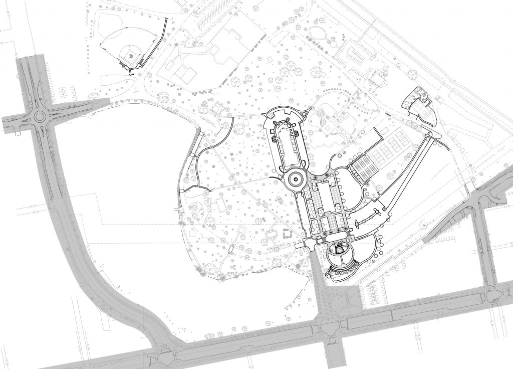
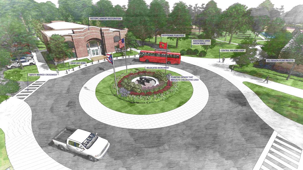
Old Memorial Armory with expanded parking and its front cul de sac is in the center. The pavilion for the Chillicothe Farmers Market and other events on the site of Diamond No. 1 is lower right from that, with the hillside amphitheater (circular pattern) below that.
From there, the park road past the current parking lot has a redesigned parking area, and angles up to the basketball court near the Pump House. Partly around that court is the a “Pump Track” for bicycle exercising in the upper right of the map – taking up a little of the festival grounds for the Earth Gathering and other events, though not all of it.
(I’m not sure if the “Pump Track” includes the Splash Pad in its center…which I would expect to be added to the pool area, but isn’t.)
Baseball Diamond No. 1 is relocated to the upper left of the map, across Back Road from Bolmer Field, behind the school building. (The site of former Diamond 1 will become the Pavilion / Farmers Market and new Pickleball Courts.)
Relocated Baseball Diamond No. 1 is in the upper left corner. Below that is the park lake (missing its left side and the YMCA). The extension of Mill Street becomes the lakeside park road, with its direct continuation to the Armory removed.
Streets around the park are shaded in grey. The single remaining traffic circle, at Yoctangee Parkway and Mill Street, is in the upper right. Water Street runs along the lower edge. Mulberry Street is in the lower right, and crosses redesigned Riverside Street in the center right side.
The site of the Hopewell Regional Visitor Center is between that intersection and the angled park road.
Water Street is angled along the left side, and Yoctangee Boulevard is across the top.
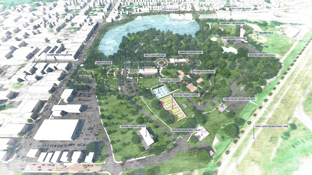
The park lake – missing its far shore, stone bridge, and the land under the YMCA – is the blue area at center top. Relocated Baseball Diamond No. 1 is to its right
Old Memorial Armory is in the center, with the Pavilion to its lower left, and Amphitheater left of that.
The Hopewell Regional Visitor Center is bottom center.
The recreation trail on the floodwall angled across the lower right.
The Paint Street entrance is in the lower left corner, and Riverside Street is in the upper right.
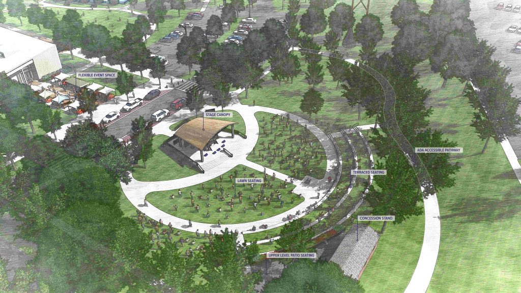
The 40 and 8 fish fry building is renovated into the “concession stand” in the lower center. The Pavilion for the Chillicothe Farmers Market and other events peeks in at the upper left corner.
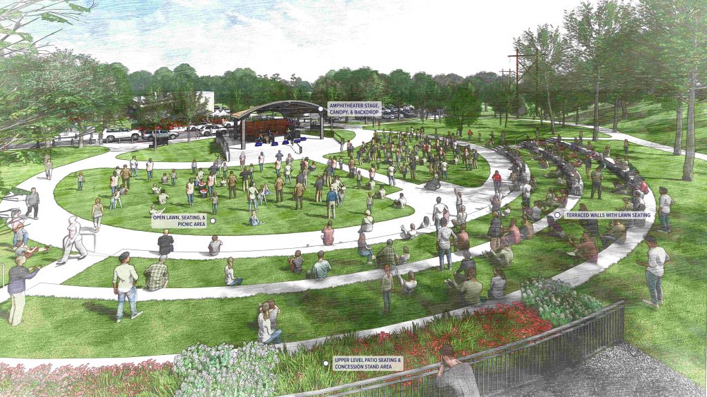
The Pavilion building is behind the stage.
A handicap-accessible bike path is in the upper right, at the foot of the hillside.
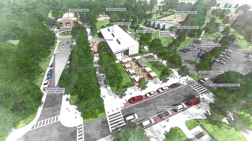
Old Memorial Armory is at the left top. Near center is the Pavilion building, with space between it and the hillside Amphitheater off the lower right corner. The redesigned parking area is right center. The Pickleball and tennis courts are upper right of the pavilion.
The Hopewell Regional Visitor Center peeks in at the upper right corner.
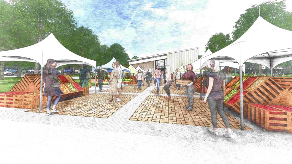
This is on the site of Baseball Diamond No. 1, along the Paint Street entrance road. Memorial Armory and a red bus in its drop-off area are visible through the tents.
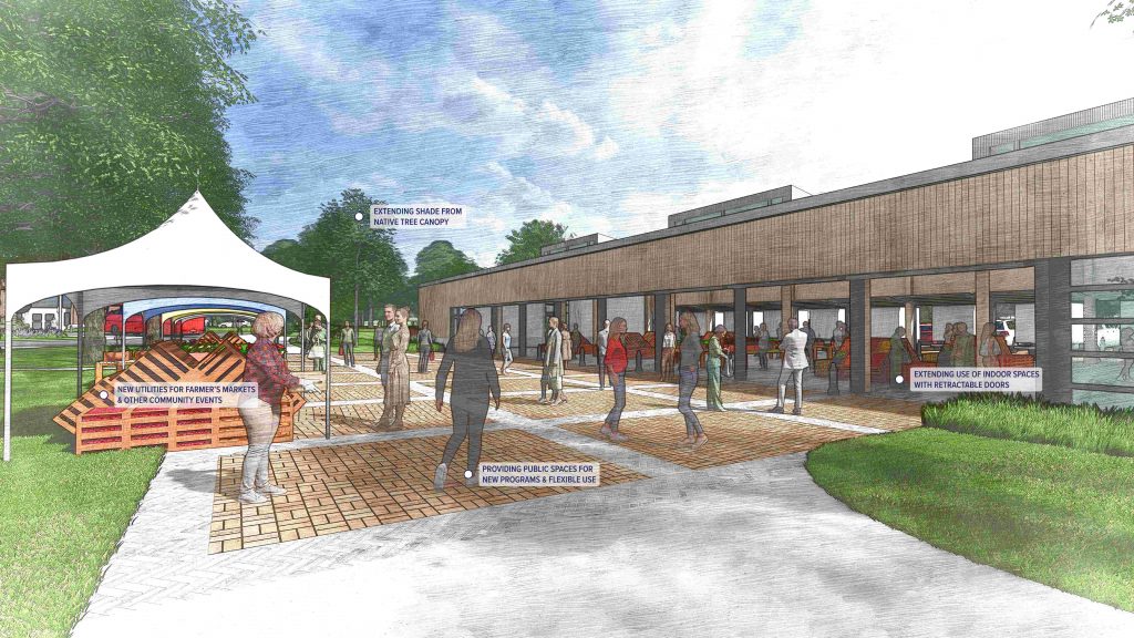
The “flexible event space” between the Pavilion and the Amphitheater, viewed from the redesigned park road.
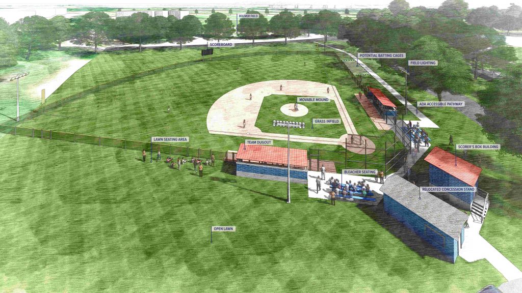
The diamond is aimed north. Back Road, the Water Treatment Plant, and Bolmer Field are at the top edge. The Mill Street entrance road runs along the right corner.
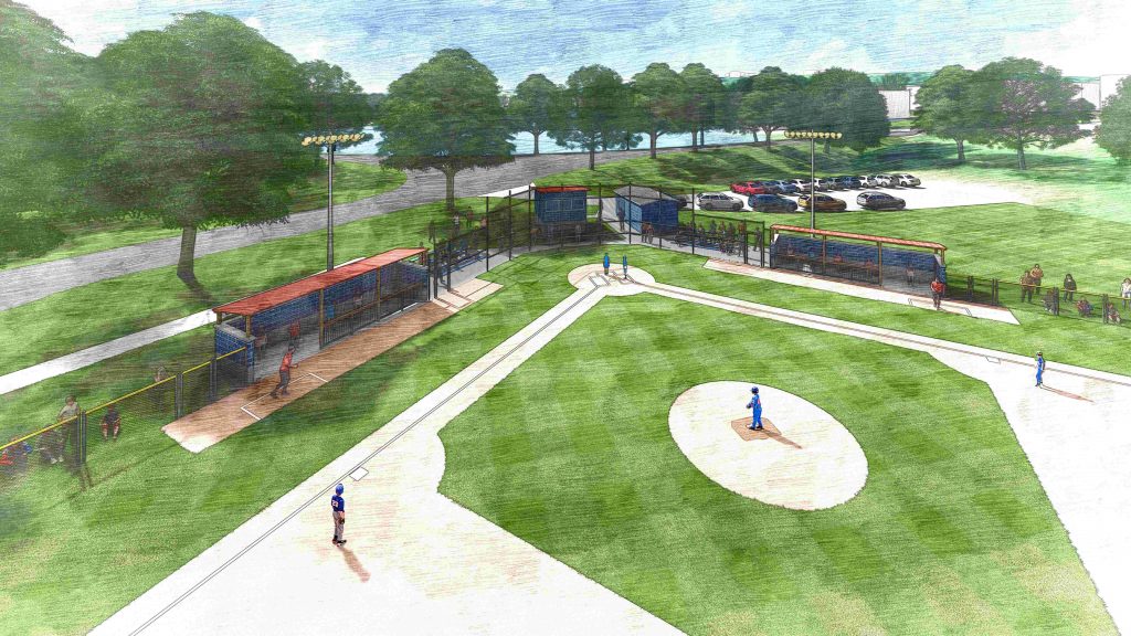
The Mill Street entrance road crosses the top, along the north end of the park lake, and the YMCA in the upper right corner. The park road to the city pool splits off in the center top.
This is on the site of the skate park (to be also relocated). The pavilion building is behind the trees in the center right, with Memorial Armory off the right edge.
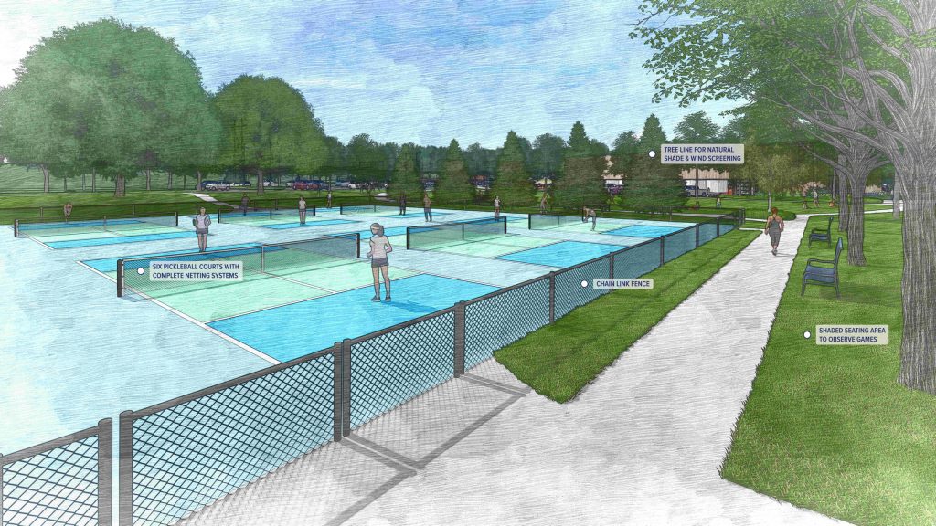
The pinkish tennis courts are beyond, in the center right. The Pump House Center for the Arts is in the upper center background. The floodwall runs across the top background.
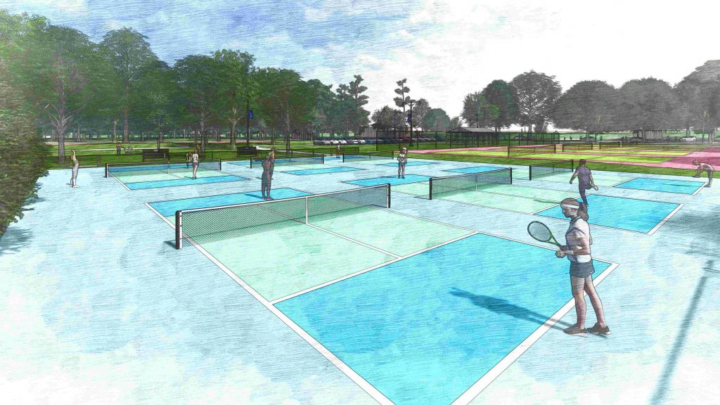
The park road at the left side has been removed. The corner of the Pavilion is in the upper right, with relocated Pickleball court beyond (in blue).
Search for many more stories on the evolution – and criticism – of the plans on the Scioto Post.


