


WILMINGTON, OH – The National Weather Service (NWS) issued an alert at 6:00 AM on Monday, June 16, 2025, forecasting a potential for localized flooding tonight and severe storms late Wednesday into Wednesday night across Ohio. The active weather pattern is expected to bring significant challenges to the region.
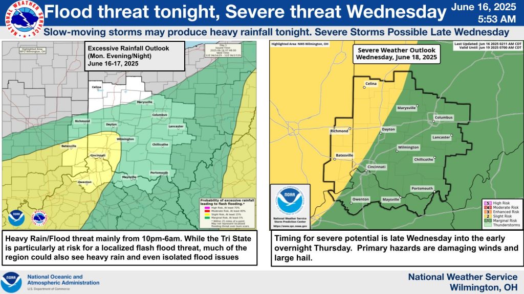
According to the NWS, slow-moving storms may produce heavy rainfall from 10 p.m. to 6 a.m., with the Tri-State area, including parts of southwest Ohio, facing a heightened risk of flash flooding. Much of the region could also experience heavy rain and isolated flood issues. A detailed excessive rainfall outlook for June 16-17 highlights areas like Chillicothe, Dayton, and Cincinnati with varying risk levels, from marginal to high.


Looking ahead, the severe weather threat escalates late Wednesday into early Thursday, with primary hazards including damaging winds and large hail. The outlook, valid until 7:00 AM on June 19, marks regions around Columbus, Wilmington, and Lancaster with a slight to moderate risk. Residents are urged to stay updated as the situation develops.


