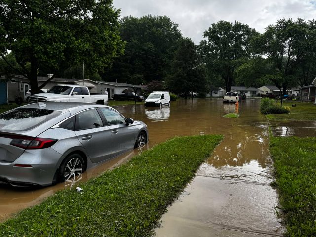
CIRCLEVILLE, OH — May 2025 has officially landed as the 12th wettest May on record for the state of Ohio, and June is already off to a soggy start — bringing major concerns for farmers and communities alike.
According to the National Weather Service, the state received 6.47 inches of rainfall in May, which is 2.48 inches above the normal monthly average of 3.99 inches. Rainfall records date back to 1879, making this a historically significant wet stretch. April was also wetter than usual, ending with 14% more precipitation than the monthly average.
Now just one week into June, Southern Ohio has already recorded 4.18 inches of rainfall, nearly reaching the 30-year monthly average of 4.79 inches. This places the region on pace for yet another above-average month, with Ohio’s wettest month — July — still to come.
While the surplus of rain might seem like a boon for agriculture, many farmers are struggling. Saturated fields and persistent mud have delayed planting for some, creating ripple effects for the growing season.
Locally, the persistent rains caused significant flooding in Circleville. On Wednesday, floodwaters overran local creeks, triggering closures on North Court Street, Lancaster Pike, and Watt Street. Streets, parking lots, and even homes were impacted, with early estimates suggesting thousands of dollars in damage.
“This isn’t just a nuisance,” one resident said. “Some people still can’t reach parts of their property.”
With the skies showing no signs of clearing, the National Weather Service warns that more rain is likely later today, compounding an already wet and frustrating week for residents across the region. Long range forcast are calling for a weekend of rain next week, starting on Saturday, the 14th, and rain issues until event Wensday the 18th with rain inbetween.


