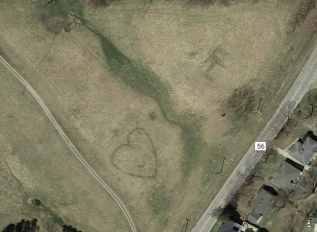
Fairfield – A woman posted on Facebook that she found something while looking for an address on google maps, a Heart, and two letters capital F and C.
We jumped on the maps and looked to find it ourselves and just at Wetsell ave and Sheridan Dr. you can see a heart and the two letters clearly. The heart and letters are as big as the houses beside them.
At this time no one knows why they have been created and who created them, but speculators say that the “FC” possibly stands for Fisher Catholic a school in the area, or maybe someone’s initials.
Google maps takes millions of photos so these photos could be years old, so the mystery may never be solved.
To see the crop circles on the map click here: https://www.google.com/maps/place/Sheridan+Dr,+Lancaster,+OH+43130/@39.7250608,-82.5775745,336m/data=!3m1!1e3!4m5!3m4!1s0x88478aaf5431bd31:0x97f51a01c5d3262b!8m2!3d39.7377118!4d-82.5698243


